
پرونده:FrontLines Environment Photo Contest Winner -5 (5808476109).jpg
اندازهٔ این پیشنمایش: ۸۰۰ × ۵۳۴ پیکسل. کیفیتهای دیگر: ۳۲۰ × ۲۱۴ پیکسل | ۶۴۰ × ۴۲۷ پیکسل | ۱٬۰۲۴ × ۶۸۳ پیکسل | ۱٬۲۸۰ × ۸۵۴ پیکسل.
پروندهٔ اصلی (۱٬۲۸۰ × ۸۵۴ پیکسل، اندازهٔ پرونده: ۴۳۲ کیلوبایت، نوع MIME پرونده: image/jpeg)
این پرونده در ویکیانبار موجود است. محتویات صفحهٔ توصیف آن در زیر نمایش داده میشود. |
.jpg?uselang=fa)
خلاصه
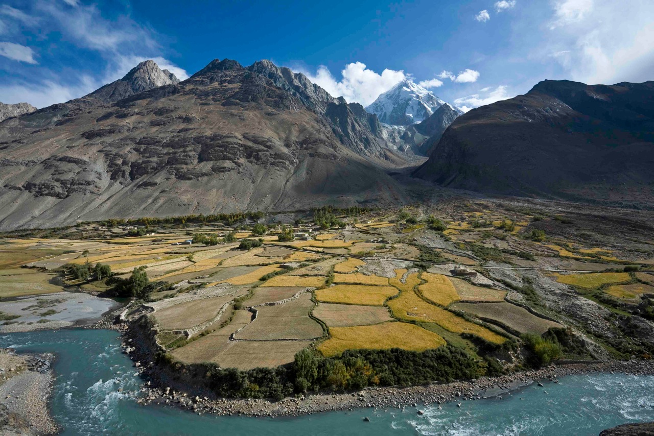
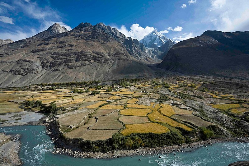
| توضیح | Here, a dramatic view of flood plain cultivation in Wakhan, Afghanistan. Known as "the roof of the world," the Wildlife Conservation Society says the Wakhan Corridor has few rivals in terms of scenic beauty. The little-known area is nestled in the high Pamir Mountains and the region is flanked by the Hindu Kush, Himalayn, Karakoram, and Kunlun ranges. Credit: John Winnie Jr., WCS-Afghanistan |
| تاریخ | |
| منبع | FrontLines Environment Photo Contest Winner #5 |
| پدیدآور | USAID U.S. Agency for International Development |
| مختصات دوربین | | محل قرارگیری این نگاره و سایر نگارهها در: نقشهٔ شهری باز |
|---|
.jpg¶ms=036.952778_N_0072.962500_E_globe:Earth_type:camera__&language=fa)
| مختصات شیء | | محل قرارگیری این نگاره و سایر نگارهها در: نقشهٔ شهری باز |
|---|
.jpg¶ms=036.951111_N_0072.962778_E_globe:Earth_class:object_type:object__&language=fa)
The geographical information in this file was retrospectively estimated.
The location may therefore be somewhat imprecise. Verifying and refining these coordinates is strongly encouraged. |
- Notes on location estimate
- Identify village by shape of the farm field
اجازهنامه
This image is a work of a United States Agency for International Development employee, taken or made as part of that person's official duties. As a work of the U.S. federal government, the image is in the public domain in the United States.
See also: The USAID privacy policy and the USAID Office of Inspector General "Disclaimers & Notices" page
|
 |
| این نگاره در ابتدا توسط USAID_IMAGES در https://flickr.com/photos/46658241@N06/5808476109 به فلیکر ارسال شدهاست و در ۴ ژانویهٔ ۲۰۱۷ توسط ربات FlickreviewR بازبینیشده و اینکه نگاره تحت مجوز United States Government Work منتشر شدهاست تأیید شد. |
تاریخچهٔ پرونده
روی تاریخ/زمانها کلیک کنید تا نسخهٔ مربوط به آن هنگام را ببینید.
| تاریخ/زمان | بندانگشتی | ابعاد | کاربر | توضیح | |
|---|---|---|---|---|---|
| کنونی | ۴ ژانویهٔ ۲۰۱۷، ساعت ۰۲:۰۶ | | ۱٬۲۸۰ در ۸۵۴ (۴۳۲ کیلوبایت) | Reguyla | Transferred from Flickr via Flickr2Commons |
کاربرد پرونده
صفحههای زیر از این تصویر استفاده میکنند:
کاربرد سراسری پرونده
ویکیهای دیگر زیر از این پرونده استفاده میکنند:
- کاربرد در arz.wikipedia.org
- کاربرد در be.wikipedia.org
- کاربرد در bg.wikipedia.org
- کاربرد در ca.wikipedia.org
- کاربرد در ceb.wikipedia.org
- کاربرد در cs.wikipedia.org
- کاربرد در de.wikipedia.org
- کاربرد در de.wikivoyage.org
- کاربرد در el.wikipedia.org
- کاربرد در en.wikipedia.org
- کاربرد در en.wikivoyage.org
- کاربرد در eo.wikipedia.org
- کاربرد در es.wikipedia.org
- کاربرد در eu.wikipedia.org
- کاربرد در he.wikivoyage.org
- کاربرد در ja.wikipedia.org
- کاربرد در pl.wikipedia.org
- کاربرد در pl.wiktionary.org
- کاربرد در ru.wikipedia.org
- کاربرد در ru.wikinews.org
- کاربرد در sv.wikipedia.org
- کاربرد در ta.wikipedia.org
- کاربرد در uk.wikipedia.org
- کاربرد در ur.wikipedia.org
- کاربرد در www.wikidata.org
- کاربرد در zh.wikipedia.org
.jpg)